Edgware Road runs along the line of a Roman road laid down almost two thousand years ago. Between then and now it has been a medieval forest track, London's execution route, a Victorian high street, the birthplace of British cinema and, since the 1970s, the heart of the city's Middle Eastern community. This guide covers all of that — and then answers the practical question most people arrive here with: what an Edgware Road taxi to each London airport actually costs.
The road: Edgware Road runs north-west from Marble Arch, following the alignment of Watling Street, a Roman military road built after the invasion of AD 43. It carries the A5 designation for much of its length.
The Arab Quarter: the stretch between Marble Arch and the Marylebone Flyover is home to London's best-known concentration of Lebanese, Egyptian, Syrian and Iraqi restaurants, shisha cafés and late-night dining.
Not the same as Edgware: Edgware Road is the street in W2. Edgware is a separate suburban town in HA8, around 10 miles further out. Airport fares differ noticeably between the two.
Airports: London City is the shortest run from W2 at 11 miles, Heathrow the closest major airport at 16 miles, and Stansted the furthest at 49 miles.
First, Which Edgware Do You Mean?
This trips up more bookings than almost anything else in West London, so it's worth clearing up before anything else. There are two entirely separate places with near-identical names, roughly ten miles apart, and quoting a fare for the wrong one can mean a difference of thirty pounds or more.
| Edgware Road | Edgware | |
|---|---|---|
| Postcode | W2 | HA8 |
| What it is | A street in central London | A suburban town |
| Location | From Marble Arch, Zone 1 | ~10 miles north-west, Zone 5 |
| Known for | Arab Quarter restaurants | Broadwalk Centre, Canons Park |
| Taxi to Heathrow | ~16 miles, from £58 | ~17 miles, similar |
| Taxi to Gatwick | ~40 miles, from £69 | ~65 miles, noticeably more |
The rest of this guide covers Edgware Road, the W2 street. If you actually need a car from Edgware HA8, the section below has the fares for that instead — or just enter the postcode rather than the place name, and the fare calculator will pick the correct location automatically.
Edgware HA8: Airport Fares for the Northern Town
Plenty of people searching Edgware taxis airport routes mean the suburban town at the top of the Northern line rather than the street in W2, so here are those fares separately. The pattern is genuinely different: Edgware sits close to the M1, which makes Luton unusually cheap, while Gatwick on the far side of London becomes the expensive one.
| Airport | Distance | Fare from | Notes |
|---|---|---|---|
| Heathrow | ~17 miles | from £48 | Closest; straightforward A41/M4 run |
| Luton | ~21 miles | from £52 | Straight up the M1 — no cross-London traffic |
| London City | ~19 miles | from £62 | Short in miles, slow through East London |
| Stansted | ~40 miles | from £68 | Via the A406 and M11 |
| Gatwick | ~64 miles | from £92 | Full M25 run; the longest of the five |
A minicab Edgware to Luton Airport is the standout here. At around 21 miles almost entirely on the M1, it avoids central London completely, and the fare reflects that. Anyone in HA8 flying budget short-haul is usually better off checking Luton first before assuming Gatwick or Stansted, simply because the ground transport cost is so much lower.
An Edgware to Stansted airport taxi runs via the North Circular and M11 at around 40 miles — longer, but still avoiding the worst of the centre. Gatwick is the one to think about carefully: at roughly 64 miles it is nearly triple the Luton distance, and the M25 southbound stretch is where delays actually happen. If your flight is available from more than one airport, that comparison is worth making before you book.
One practical note on cab service Edgware residents ask about: the HA8 postcode area is large, covering Canons Park, Burnt Oak, Edgwarebury and the town centre, and fares vary a little across it. Giving your full postcode rather than just “Edgware” gets you an accurate quote first time.
Edgware Road to Every London Airport — Real Fares
Most people searching for Edgware Road end up needing one of two things: to understand the area, or to get out of it and to an airport. Here's the second part — an Edgware Road taxi to airport pricing table, with distances and fixed fares for all five London airports from a W2 pickup. Edgware Road to airport transfers are priced per vehicle, not per passenger, which matters once there are more than two of you.
The pattern here is worth noticing: London City is the shortest journey by distance but not always the quickest, because the route crosses Central London rather than picking up a motorway early. Heathrow, despite being five miles further, often takes a similar time thanks to the A40 and M4 doing most of the work. Gatwick and Stansted are both proper motorway runs via the M25.
Book Your Edgware Road Airport Taxi — Fixed Price, Any Airport
From £52 · Door-to-door · 24/7 · TfL-licensed · No surge
The Road Itself: A Timeline
Few streets in Britain have carried traffic continuously for as long as this one. The tarmac is modern; the alignment underneath it is not. Here's the whole span at a glance before we go through it properly.
1. The Roman Road Underneath
Edgware Road follows the course of Watling Street, one of the principal roads of Roman Britain. Built in the decades after the invasion of AD 43, it linked the Channel ports through Londinium and on towards Verulamium, modern St Albans, and eventually Wroxeter in Shropshire — a run of roughly 300 miles end to end. Roman itineraries list it as iter III, and it carried military traffic, imperial post and trade for the best part of four centuries.
Interestingly, the Romans did not create the route from nothing. The evidence suggests an existing British trackway through the Great Middlesex Forest already ran roughly this way; what the Romans did was survey it properly, straighten it and pave it. The modern road still runs for close to ten miles in an almost perfectly straight line, which is genuinely unusual in London — a city whose street pattern is otherwise a thousand years of improvisation. That straightness is the Roman survey still showing through.
The Romans chose this line for reasons that still make sense on a map. It offered the shortest practical route north-west out of the settlement, skirted the heavy clay and dense woodland of what would later be called the Great Middlesex Forest, and connected a chain of military and trading posts along the way. Roman surveyors favoured long straight alignments, and the modern road still runs remarkably true to that original line for much of its course.
| Roman period | Today | What survives |
|---|---|---|
| Watling Street | A5 / Edgware Road | The alignment itself |
| Londinium | The City of London | Street pattern in places |
| Straight surveying | Modern road layout | Long uninterrupted stretches |
| Roadside settlements | Marble Arch, Kilburn, Edgware | Place names and locations |
Archaeological work along the corridor has periodically turned up Roman material, including pottery production evidence at Brockley Hill further north. The road surface you drive on today sits on nearly two millennia of accumulated layers — a genuinely unusual thing to be able to say about a working London street.
2. The Medieval Forest Road
After the Roman administration withdrew in AD 410, organised road maintenance across Britain effectively stopped. Watling Street did not disappear, but it degraded from an engineered highway into a rutted track, and it stayed that way for the better part of a thousand years.
Through the medieval period the route still mattered. It connected London to the agricultural land of Middlesex and Hertfordshire, carrying grain, livestock and timber into a growing city. The surrounding Great Middlesex Forest supplied building timber and firewood, offered hunting grounds for the nobility, and gave cover to anyone with a reason to avoid being seen.
Travel was genuinely risky. Medieval accounts of routes like this one describe deep mud in winter, wild animals, and robbery as ordinary hazards rather than exceptional events. Small settlements grew up along the road partly because travellers needed somewhere to stop before dark — and one of those settlements became the village of Edgware.
The road also served as a pilgrim route, carrying people north towards religious houses and shrines beyond London. That traffic, alongside the farm carts and drovers, kept a string of inns in business along the way. Several of those coaching inns survived into the turnpike era and a handful of the buildings still stand, now doing rather different trade — which means there are pubs on this road that have been serving travellers, in one form or another, for centuries.
3. Why Is Edgware Called Edgware?
The name has nothing to do with edges or wares. It comes from Old English, and the reading most historians settle on is “Ecgi's weir” — a fishing weir, meaning a dam or trap built across a watercourse, held by a Saxon landholder named Ecgi.
| Year | Recorded as | Source |
|---|---|---|
| 1086 | Egge | Domesday Book |
| 1216 | Eggwere | Medieval records |
| 1502 | Edgeworth | Tudor records |
| 1754 | Edgware | Standardised spelling |
The weir in question sat on one of the local brooks — Edgware Brook or Deans Brook — well north of the modern W2 stretch. The street took its name from where it led, not from anything at the Marble Arch end. That is also why misspellings like “Edgeware Road” are so persistent: the extra “e” looks right to modern eyes, but it never belonged there.
4. Tyburn: The Gallows at Marble Arch
For roughly six centuries, the junction at the southern end of Edgware Road was where London executed people. Tyburn stood close to the site of the modern Marble Arch, and it operated as the city's principal public execution ground until 1783.
The condemned were brought from Newgate Prison along what is now Oxford Street — the road was called Tyburn Road for exactly this reason — to the gallows at the end. Execution days drew crowds numbering in the thousands and were treated, uncomfortably to modern sensibilities, as public entertainment. The “Tyburn Tree”, a triangular gallows structure, was built to hang multiple people at once.
The last execution at Tyburn took place on 7 November 1783, after which the site moved to Newgate itself. A plaque near Marble Arch marks the location today, and the Tyburn Convent on Hyde Park Place maintains the memory of those executed there for their faith. Anyone travelling south down Edgware Road towards Marble Arch passes directly through the site without any particular sign of it.
5. Turnpikes and Highway Robbery
In 1711 a turnpike trust took over stretches of the road, charging tolls to fund repairs. The surface improved. So, unfortunately, did the opportunities for robbery: toll gates forced traffic to slow and stop at predictable points, which is precisely what an ambush needs.
Through the 17th and 18th centuries the roads out of London developed a genuine reputation for highway robbery, and this was one of the busier ones. The most famous name attached to the period is Dick Turpin (1705–1739), though the historical record and the folk legend diverge sharply. The ballads made him a gallant figure on a horse called Black Bess; the court records describe a violent housebreaker who tortured victims during robberies, ran with the Essex gang, and was eventually hanged at York in April 1739 for horse theft rather than anything romantic.
What the Authorities Did About It
The response built up gradually through the 18th century: mounted patrols on the main approaches, substantial rewards for information leading to conviction, oil lamps and later gas lighting along the busier stretches, and the grim deterrent of displaying executed robbers' bodies in gibbet cages near the scenes of their crimes. By the early 19th century, organised highway robbery on London's approaches had largely collapsed — a combination of better policing, better lighting, and simply too much traffic to pick off a lone carriage unnoticed.
6. Telford, the Huguenots, and Britain's First Curry House
The early 19th century gave Edgware Road three things at once that rarely get mentioned together, and one of them changed British food permanently.
Thomas Telford's Redesign, 1811
By the early 1800s the route had become part of the London to Holyhead road — the main artery to the Irish Sea packet ships, and therefore to Dublin. Parliament wanted it fit for mail coaches running to a timetable, and the engineer given the job was Thomas Telford. His redesign, produced in 1811, is generally regarded as one of the most significant feats of pre-Victorian civil engineering in Britain: consistent gradients, properly drained foundations, and a surface built to survive heavy year-round coach traffic rather than patched season by season.
What that meant in practice was that a road first surveyed by Roman engineers was re-engineered, almost eighteen centuries later, by the man who also built the Menai Suspension Bridge and the Caledonian Canal. Not many streets can claim two separate periods of genuinely world-class road engineering.
The Huguenot Arrivals
Through the 18th century the area drew Huguenot migrants — French Protestants who had fled persecution and settled across several parts of London, bringing silk weaving, watchmaking and other skilled trades. This matters for how you read the road's later history: the Middle Eastern community that defines it today was not the first migrant community to shape the street, but the most recent in a sequence going back several centuries.
1810: Britain's First Indian Restaurant
In 1810, a year before Telford's redesign, Sake Dean Mahomed opened the Hindoostane Coffee House near the southern end of Edgware Road — the first Indian restaurant in Britain. Mahomed had served in the East India Company army, moved to Ireland and then London, and opened a place serving Indian food to a British public that had essentially never encountered it in a restaurant setting.
Taken together, these three strands say something about the road that a list of dates does not: Edgware Road has been absorbing new arrivals and their food, trades and money for a very long time. What happened in the 1970s was a continuation, not a break.
6. The Victorian Transformation
The 19th century did more to Edgware Road than the previous fifteen combined. London expanded outwards at a pace that turned a semi-rural highway into a dense urban thoroughfare within a couple of generations.
| Year | Development | Effect |
|---|---|---|
| 1863 | Metropolitan Railway opens | World's first underground railway; Edgware Road among its original stations |
| 1868 | Second station opens nearby | The two-station arrangement that still confuses visitors today |
| 1870s | Street widening | Room for growing traffic and grander frontages |
| 1880s | Gas street lighting | Safer evenings; the beginning of a night economy |
| 1890s | Electric trams | Affordable mobility for working-class residents |
The station opening in January 1863 deserves its own note. The Metropolitan Railway between Paddington and Farringdon was the first underground passenger railway anywhere in the world, and Edgware Road was on it from day one. Much of the Victorian building stock from this period survives along the road: stucco frontages, commercial ground floors with flats above, sash windows and decorative cornices, often now hosting businesses their builders could never have imagined.
7. Where British Cinema Started
Leicester Square gets the credit today, but London's cinema industry began further west. In 1909, Montagu Pyke — a showman who became known as the Cinema King — opened one of the capital's earliest purpose-built cinemas on Edgware Road, and his reasoning was refreshingly commercial: the neighbourhood was densely populated, and the people walking past it every day would happily pay for entertainment if you priced it for them.
He was right. Over the following two decades Edgware Road became something close to an entertainment district in its own right, with several substantial venues operating within walking distance of one another. What made it work was a combination of factors that rarely align: a large local audience, excellent tram and tube connections bringing people in from further out, a wide street that allowed cinemas to build impressive frontages, and enough competition between venues to keep ticket prices down.
The decline came in the 1960s and 1970s, and it came for the same reasons it came everywhere else: television ownership became near-universal, and the new multiplex format favoured suburban sites with parking. The last of the road's classic cinemas closed in the early 1980s. Several of the buildings survive in other uses, and if you know what you're looking at, the proportions of the facades still give them away.
9. The Arab Quarter
This is the part most people get slightly wrong, including a good deal of what's written about the road online. The Middle Eastern presence on Edgware Road did not begin in the 1970s. It arrived in three distinct waves across roughly a century.
| Period | What happened | Driver |
|---|---|---|
| Late 19th century | First Arab merchants settle in the area | Expanding trade with the Ottoman Empire |
| 1950s | Egyptian arrivals establish a visible community | Post-war migration and political change in Egypt |
| 1970s onward | Rapid expansion; the area takes on its present character | Lebanese civil war, regional instability, Gulf wealth |
The 1970s were when the street became recognisably what it is today, but the foundations were laid by merchants who arrived when Queen Victoria was still on the throne. That century of continuity is part of why the community here feels established rather than recent.
Why This Particular Street
Several things aligned. The embassy districts of Mayfair and Knightsbridge were close by. Commercial property became affordable as the cinemas closed through the 1960s and 70s. Transport connections ran in every direction. And the Victorian building stock — deep ground-floor units with residential space above — converted naturally into restaurants with flats over them. An existing Lebanese merchant presence gave newer arrivals somewhere to start.
What You'll Find There Now
The concentration of Middle Eastern food along the stretch between Marble Arch and the Marylebone Flyover is genuinely unusual for a European city: Lebanese mezze houses, Egyptian cafés serving strong coffee late into the night, Syrian bakeries turning out flatbread through the day, Iraqi restaurants with regional specialities like masgouf, and shisha cafés with pavement seating that stays busy long after most of London has closed. Arabic shopfront signage is the norm rather than the exception along parts of the road. The area picked up several informal names along the way — Little Beirut, Little Arabia, Little Cairo — none of them official and all of them still in use.
The local Odeon cinema was for years one of the few large London screens regularly showing films in Arabic, which tells you something about how established the community became. The rhythm of the area shifts noticeably during Ramadan, when the evening iftar draws large numbers and restaurants run well past midnight. If you're booking transport around that period, allowing extra time for traffic through this stretch is sensible rather than cautious.
9. Paddington Basin and the Modern Edge
At the eastern side of the road, the Paddington Basin development turned former canal-side industrial land into a commercial and residential quarter through the 2000s. The Paddington Waterside partnership formed in 2001, the first offices completed in 2004, and Thomas Heatherwick's Rolling Bridge — a curling footbridge that furls itself into a circle — was installed in 2007 and remains one of the more genuinely surprising pieces of engineering in central London.
The practical effect on Edgware Road has been a steady increase in weekday commuter traffic at its eastern end, alongside improved canal-side walkways and better pedestrian connections towards Paddington station. It also means the road now runs past 21st-century glass and Victorian stucco within the same few hundred metres.
The Road Changes Its Name Five Times
Here is something that catches out visitors and occasionally locals: Edgware Road does not stay called Edgware Road. Over its ten-mile run it picks up a series of different names, all describing the same continuous road, most of it carrying the A5 designation.
| Section | Name | Rough location |
|---|---|---|
| Southern start | Edgware Road | Marble Arch northwards, W2 |
| After the flyover | Maida Vale | W9 |
| Continuing north | Kilburn High Road | NW6 |
| Beyond Kilburn | Shoot Up Hill | NW2 |
| Further north | Cricklewood Broadway | NW2 |
| Northern end | Edgware Road again | Towards Edgware, HA8 |
This matters practically when booking a car. If someone says “pick me up on Edgware Road” they almost certainly mean the W2 stretch near Marble Arch — but the name also applies at the far northern end, ten miles away. Giving a postcode rather than a street name removes the ambiguity entirely, which is why every booking form asks for one.
The road also does something unusual administratively: it serves as the boundary between four London boroughs along parts of its length — Harrow and Brent on the western side, Barnet and Camden on the eastern. A single continuous street forming the edge of four local authorities is a direct legacy of its age. Parish and county boundaries were drawn to follow the Roman road because it was already there and already obvious, and those lines have survived every reorganisation since.
10. What Edgware Road Is Known For Today
Ask ten people and you'll get several answers, which is itself the point. The road does more than one thing at once.
| Draw | Where | Notes |
|---|---|---|
| Middle Eastern dining | Marble Arch to Marylebone Flyover | The area's defining feature; late-night trade |
| Transport connections | Two tube stations, major bus routes | Circle/District/H&C and Bakerloo lines |
| Historic sites | Tyburn memorial, Victorian frontages | Mostly unmarked; you need to know where to look |
| Specialist shopping | Along the southern stretch | Halal butchers, international groceries, electronics |
| Canal-side walking | Paddington Basin, Little Venice | Quiet contrast to the main road |
The stretch north of the flyover changes character noticeably — more residential, less commercial, and increasingly suburban as it heads towards Kilburn, Cricklewood and eventually Edgware itself. The road covers around ten miles end to end, and the two ends have almost nothing in common.
Getting from Edgware Road to the Airport
W2 is unusually well connected, which means there is genuinely more than one sensible way to reach most airports. Here's how the options actually compare rather than how they look on a route planner.
| Option | Time | Changes | With luggage |
|---|---|---|---|
| Pre-booked taxi | 35–50 min | None — door to terminal | Driver handles it |
| Heathrow Express via Paddington | ~15 min + getting to Paddington | 1 — walk or tube to Paddington | Carried to the station |
| Elizabeth line via Paddington | ~30 min + getting to Paddington | 1 | Carried to the station |
| Piccadilly line | 60–75 min | 1–2 | Stairs and interchanges |
Heathrow is the one airport where public transport from W2 is genuinely competitive. Paddington station sits close to the eastern end of Edgware Road, and the Heathrow Express covers the distance in about fifteen minutes. For a solo traveller with a cabin bag, that is hard to beat on time.
It stops being competitive fairly quickly, though. Two people with checked luggage are already paying twice for train tickets and still have to get themselves and their cases to Paddington first. A family of four is comfortably better off in one car. And for Gatwick, Luton or Stansted, every rail route from W2 involves at least one change and often two, which is where booking an Edgware Road minicab direct to the terminal stops being a luxury and starts being the obvious answer.
Vehicle Options from W2
Whether you need a standard saloon for an airport run or a larger vehicle for a group heading out together, the fare is per vehicle rather than per passenger. Every quote includes the airport drop-off charge and is confirmed at booking. Searches for an Edgware Road cab, an Edgware Road cab service or an Edgware Road taxi service all land in the same place: a licensed private hire booking with the fare agreed upfront.
| Vehicle | Passengers | Fixed fare | Luggage |
|---|---|---|---|
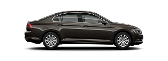
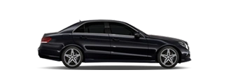
| Saloon | 1–4 | from £58 | 2–4 cases |
| Estate | 1–4 | from £68 | 4–5 cases |
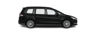
| MPV / 6-seater | 4–6 | from £78 | 5–6 cases |
| 8-seater minibus | 7–8 | from £95 | 7–8 cases |
The saloon covers most bookings comfortably. The estate is worth the difference if you're one or two people with unusually bulky luggage rather than more people. The MPV becomes the sensible choice at five or six passengers, and the 8-seater takes a full group of eight in a single vehicle — which for a family travelling together to the same flight almost always works out better than splitting across two cars, both on cost and on not losing anyone.
Coming Back to Edgware Road
The return leg is priced the same as the outbound, and the practical difference is where you meet the driver.
| Leg | Where you meet the driver | Fare |
|---|---|---|
| Edgware Road → airport | Your W2 address | Same fixed fare |
| Airport → Edgware Road | Arrivals hall, name board | Same fixed fare |
On arrivals, your driver waits inside the terminal with a name board rather than in a car park or at a kerbside pickup point, which matters more than it sounds after a long flight with luggage. Flight tracking adjusts the pickup time automatically if you land late, so a delay doesn't require a phone call from baggage reclaim. Complimentary waiting time from actual landing is included as standard, covering the usual immigration and baggage delays.
One local detail worth knowing about cabs in Edgware Road: dropping at an address here is straightforward, but the road itself is busy and often has restrictions on stopping along the southern stretch. If you're booking a mini cab Edgware Road pickups work best from a side street rather than the main carriageway. Giving your driver the specific side street or building entrance when you book usually saves a few minutes at the end of the journey.
Practical Notes for Edgware Road
Parking and the Congestion Charge
On-street parking along the southern part of Edgware Road is limited, expensive and heavily restricted. The area also falls inside the Congestion Charge zone during charging hours, and much of central London is within the Ultra Low Emission Zone, so an older vehicle can attract a second daily charge on top. For a visitor, the maths on driving in rarely works out. A pre-booked car avoids both charges and the parking problem entirely, since the driver is picking up and moving on rather than stopping.
The Two Stations Problem
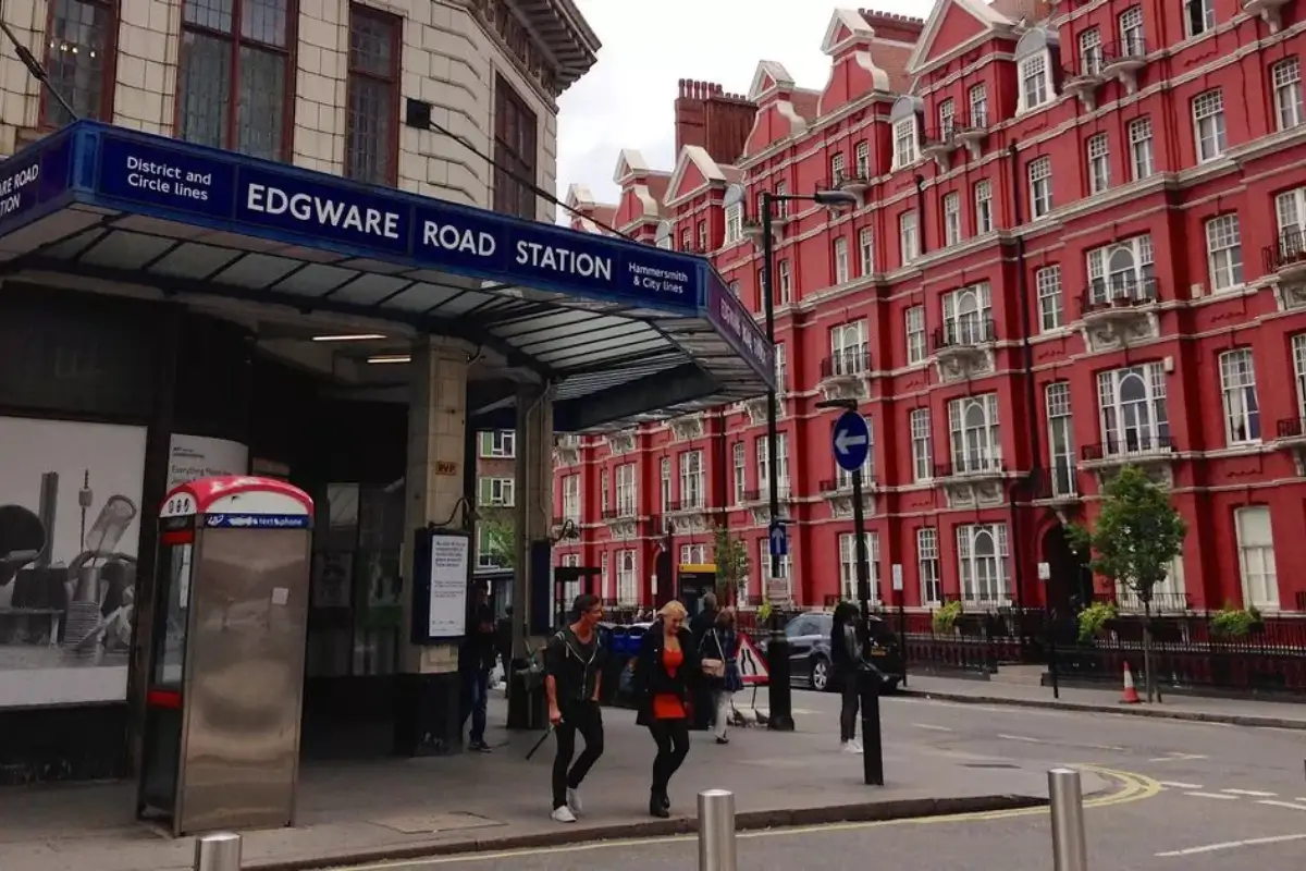
There are two separate stations called Edgware Road, roughly 200 metres apart, and they are not connected. One serves the Circle, District and Hammersmith & City lines; the other serves the Bakerloo. If someone tells you to meet them at Edgware Road station, it is genuinely worth asking which one — this catches out Londoners, never mind visitors.
Is the Area Safe at Night?
The main road stays busy well past midnight because of the restaurant trade, with good lighting and a regular police presence, particularly at weekends. The usual central London common sense applies: stay on the main lit streets rather than cutting through quieter side roads, keep valuables out of sight, and use a licensed pre-booked vehicle rather than accepting a lift from an unbooked car. Any private hire vehicle picking you up should have been booked in advance through a licensed operator — that is what the licence actually means.
Worth Seeing Along the Way
If you have time between arriving and needing to be somewhere, these sit within a short distance of the road and give you the historical span in one walk.
| Place | Where | Why |
|---|---|---|
| Marble Arch & Tyburn memorial | Southern end | The execution site; a small plaque marks it |
| Church Street Market | Just off the road | Victorian-era street market, still trading |
| The Arab Quarter | Marble Arch to the flyover | The restaurants that define the area |
| Paddington Basin | Eastern edge | Rolling Bridge and canal-side walkways |
| Little Venice | North of Paddington | Canal junction; a genuinely quiet corner |
| Hyde Park | South of Marble Arch | Across the junction from the road's start |
Marble Arch and the Tyburn memorial sit at one end, Paddington Basin at the other, and between them the Arab Quarter covers the century that actually shaped the road's present character. Walking the southern stretch from Marble Arch to the flyover takes about twenty minutes at an unhurried pace, and covers most of what people come to see. If you're being collected for an airport run and have an hour spare beforehand, that walk plus a coffee somewhere along Queensway fits the time comfortably.
Frequently Asked Questions
Related Guides
Edgware Road to Any London Airport — Fixed Price
From £52 · All 5 airports · Door-to-door · 24/7 · TfL-licensed · No surge